Introducing PPLT’s interactive map! This map was developed by Kennedy Jenks Consultants through funding generously provided by the Montana Department of Commerce. Huge thanks to both of those organizations for their help in creating this digital web map!
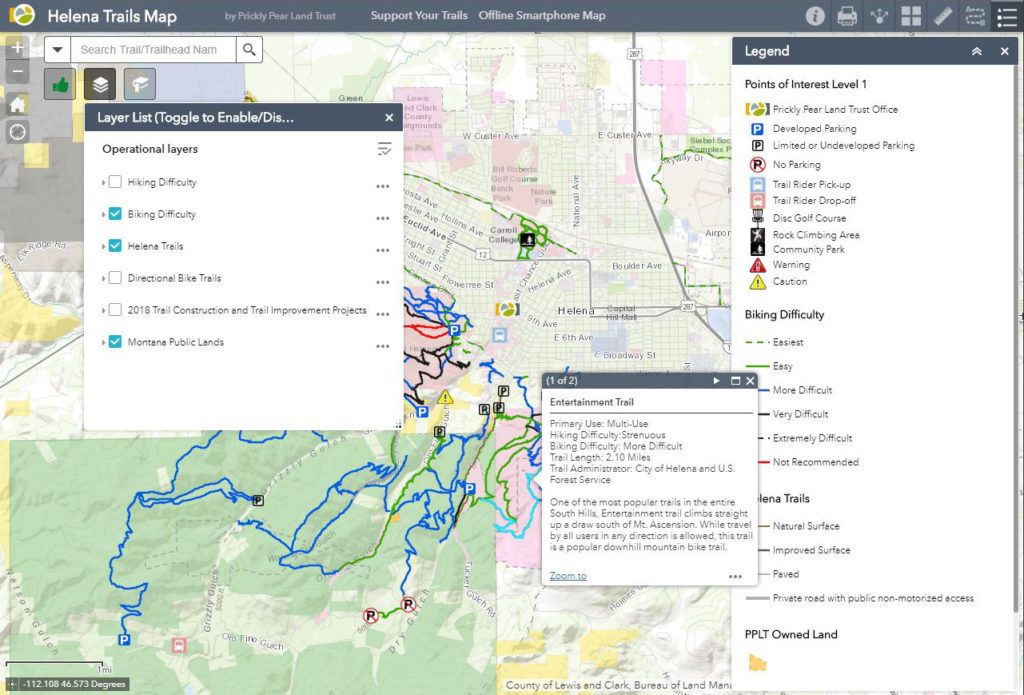
Have fun and take some time exploring the map! Toggle on and off layers to see hiking difficulty, biking difficulty, and trail projects and construction. Explore recommended routes for different ways to experience the trails on a bike, on a run or a hike by yourself or with your family. Click on the bookmarks to see different areas of the map including the Mt. Helena Climbing Area, South Hills Disc Golf Course and Scratchgravel Hills. Click on trails and other features for descriptions and links for further information.
PPLT had a great time developing this map, and we believe what you see today is just a start of what this map can be. Check out the map often as we add features and update the map with the most current and useful information. Some things to look forward to include: new recommended routes from PPLT staff and friends, new trails showing up once the snow melts up high and trails are cleared and ready to use, as well as updates to new trail construction projects as the map will change with on-the-ground results.
Tell us what you think! Please let us know what information you’d like to see added or functionality you think would be helpful.
Is your map toolbox full? The interactive map is just one tool in our toolkit of mapping solutions. Stop in to purchase a paper trail map for out on the trail or to hang on your wall and you can also download our FREE Avenza South Hills trail map to use on your smartphone or other device while out on the trails.